Research
The complexity of the Alpine orogenic belt results from the interaction of oceanic and continental lithosphere in micro-plates that are caught between two large converging plates: Europe and Africa. In striking contrast to the wealth of geological and geophysical information on various local crustal structures and time periods of the orogeny, our present understanding of the mountain building processes that shaped the Alpine orogen is pitifully limited to a sequence of simplistic 2D plate tectonic scenarios mainly due to the lack of resolution and reliable information on mantle lithosphere and asthenosphere at regional and local scales. The challenge of the AlpArray initiative is to provide the opportunity for a breakthrough in our understanding of mountain building processes from initial to final phases, including contemporary 3D-interactions of large plates with small plates and micro-ocean subduction.
This demands a multi-disciplinary, multi-lateral, and international research approach. The core data for such an effort will come through the establishment and operation of a seismic array that combines the networks of a dozen seismological observatories with a few hundred temporary broadband stations covering the Alps, the Northern Apennines and their forelands. The scientific questions and challenges outlined above can best be addressed in a co-operative research initiative that includes the following components: (1) AlpArray seismic network, (2) AlpArray complementary experiments (networks -see EASI-, swaths and profiles) including other geophysical methods like magnetotellurics, gravity and GPS, and (3) AlpArray collaborative projects . In combination, these components go far beyond seismic imaging and involve many disciplines of solid Earth sciences.

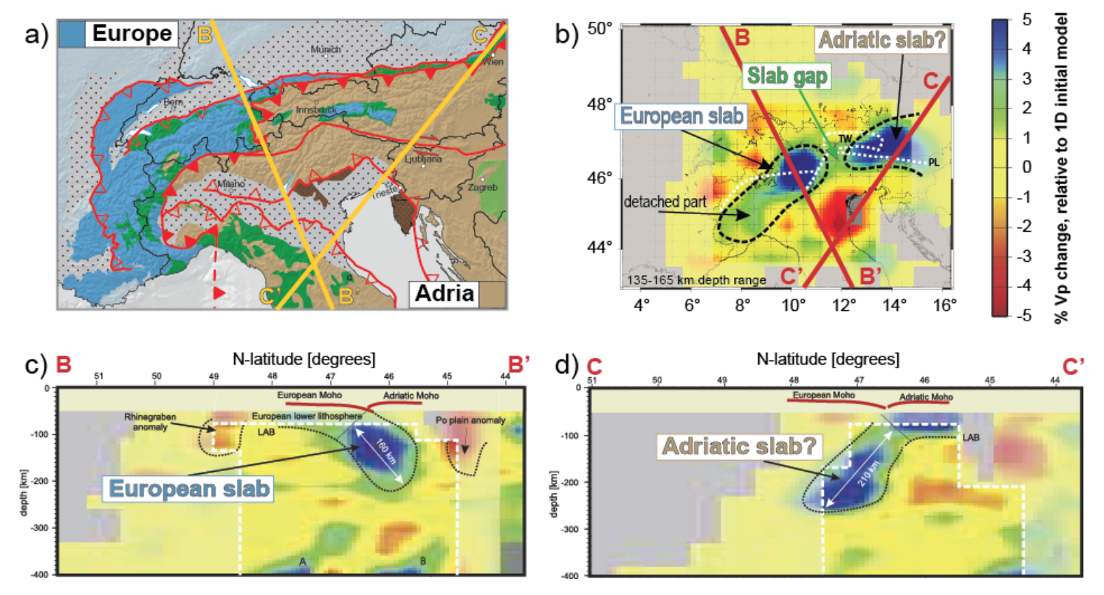
Linking the Alps’ present to its past using geology at surface and seismic tomography at depth. (a) Tectonic map from Figure 2, with profiles BB’ and CC’ shown on other sub-figures; (b) Seismic tomography depth section showing two distinct slabs beneath the Alps: one European with a detached part, and one presumably but also debatably Adriatic, with a clear slab gap in-between; (c, d) Seismic tomography profiles along lines BB’ and CC’ showing the dip and depth extent of the slabs. Seismic tomography images of Lippitsch et al. 2003.
