The AlpArray initiative
AlpArray is a European initiative to advance our understanding of orogenesis and its relationship to mantle dynamics, plate reorganizations, surface processes and seismic hazard in the Alps-Apennines-Carpathians-Dinarides orogenic system. The initiative integrates present-day Earth observables with high-resolution geophysical imaging of 3D structure and physical properties of the lithosphere and of the upper mantle, with focus on a high-end seismological array.
The complexity of the Alpine orogenic belt results from the interaction of oceanic and continental lithosphere in micro-plates that are caught between two large converging plates: Europe and Africa. The challenge of the AlpArray initiative is to provide the opportunity for a breakthrough in our understanding of mountain building processes from initial to final phases, including contemporary 3D-interactions of large plates with small plates and micro-ocean subduction.
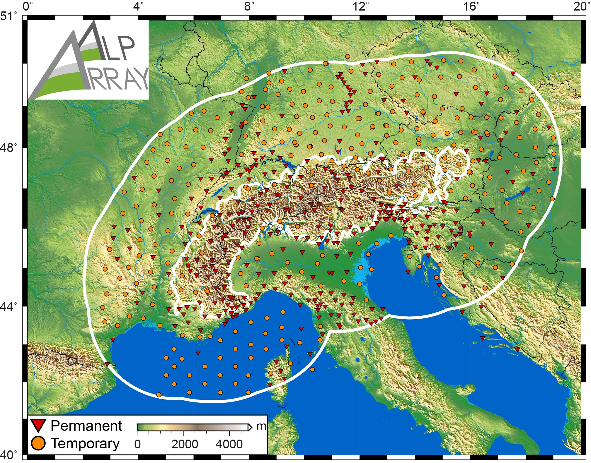
This demands a multi-disciplinary, multi-lateral, and international research approach. The core data for such an effort comes through the following components: (1) AlpArray seismic network (see map below), (2) AlpArray complementary experiments (networks, swaths and profiles) including other geophysical methods like gravity, and (3) AlpArray collaborative projects. In combination, these components go far beyond seismic imaging and involve many disciplines of solid Earth sciences.

News
April 2022
As of 1.4.2022, all Z3 (temporary station) network waveform data is openly available on EIDA. The data policy and citation information is also updated.
